Report of the Western Ghats Ecology Expert Panel - Part I - 6. Boundaries of the Western Ghats : -

Opinion
14/09/2018
1397.
6. Boundaries of the Western Ghats : -
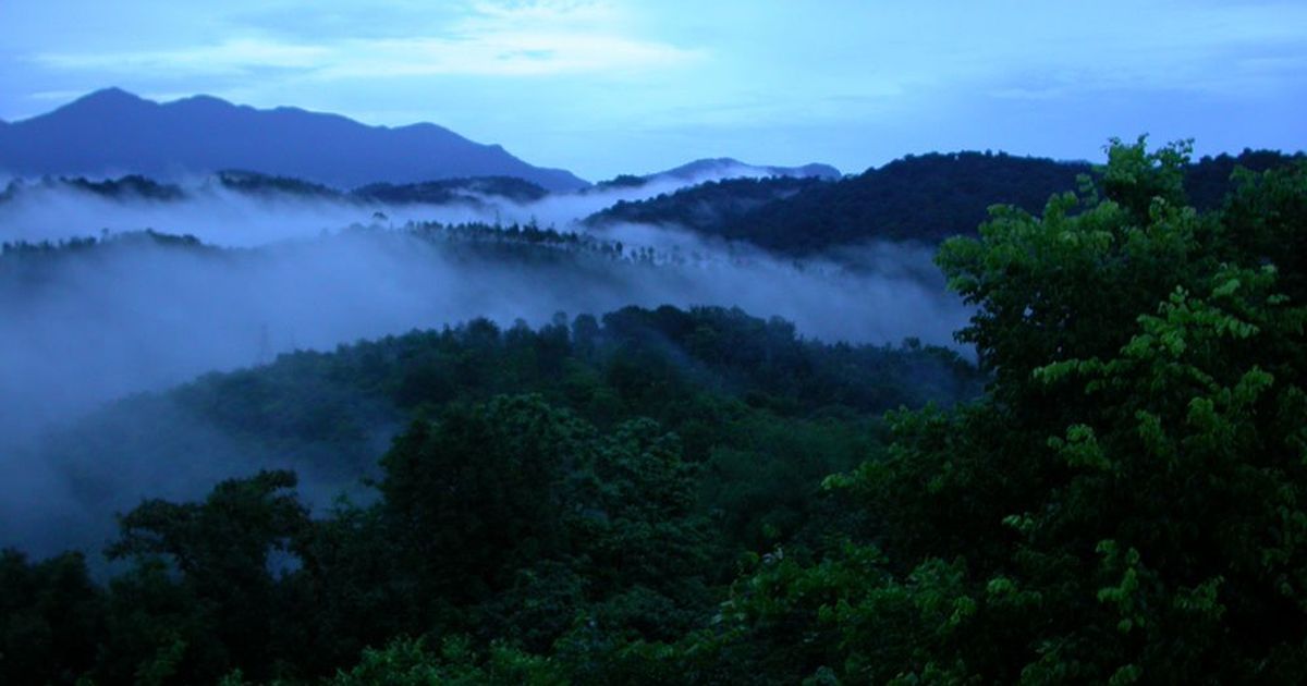
Given its mandate, WGEEP has attempted to define the Western Ghats from an environmental view-point. The term Western Ghats refers to the practically unbroken hill chain (with the exception of the Palakkad Gap) or escarpment running roughly in a north-south direction, for about 1500 km parallel to the Arabian sea coast, from the river Tapi (about 210 16’ N) down to just short of Kanyakumari (about 8019’ N) at the tip of the Indian peninsula. In some accounts the term Western Ghats or Sahyadris is restricted only to the western escarpment of the Peninsular Plateau from the Tapi southwards to the region of Kodagu, (about 12 degrees N) while the higher mountain ranges further south, including the Nilgiris, the Anamalais, the Cardamom hills and the Agasthyamalai range, being referred to as a distinct geological entity named as the Southern Block (Mani 1974). For our purposes we use the term Western Ghats in the broader sense to include the entire tract of hills from the Tapi to Kanyakumari.
Report of the WGEEP 2011
One issue that has to be resolved while defining the boundaries of the Western Ghats is its eastern limits in relation to what has been geographically termed as the Eastern Ghats. There have, however, been few attempts to accurately define the borders of these Ghats and hence the boundaries still remain elusive. The Western Ghats also have a number of eastern and western spurs, particularly in Maharashtra and Tamilnadu, making it difficult to define a precise boundary. Several institutions both at national (e.g. National Remote Sensing Agency) and international (e.g. Birdlife International, Conservation International) levels, have tried to define the boundaries, usually in the context of their biodiversity survey and conservation programmes, but these do not tally . Clearly the lack of consensus among these attempts could be because the drivers used for defining the boundaries are either not always defined or are not agreed upon.

For the purpose of defining the boundary of the Western Ghats, we used altitude and forest area or vegetation as drivers defining the boundaries. Our operational definition for the `Ghats’ therefore is forest area above a certain altitude. Accordingly we demarcated the eastern edge by identifying the forested areas that are above 500 m; the rationale for this cut off followed from the digital data which showed that, in general, 500m constitutes the elevation at which the Western Ghats rise discretely from the Deccan plateau. For the western edge, we used a cut off of forested areas at 150 m and above as the Ghats fall more steeply down to the coastline as compared to the eastern side of the Ghats1. We also found that whenever the forested areas at elevations of more than 150m drop directly into the ocean or within a distance of 1km of the coastline, it was difficult to define the coast. Hence, in such situations (as in parts of Maharashtra), the coastline itself was considered as the western edge of the Ghats. We used the land-use map developed by Forest Survey of India to demarcate forested areas, and GTOPO30 (Global 30 Arc-Second Elevation Data Set) for altitude details at 1 x 1 km resolution. The boundaries were defined by overlaying these two datasets and following the criteria defined above. We also used the annual cumulative NDVI (normalized differential vegetation index) values as a surrogate for vegetation or forest cover2 but eventually found that the Forest Survey of India’s map per se was sufficient for the purpose.

It is generally agreed upon in the scientific literature that the southern-most and western-most extent of the Eastern Ghats is the hill range in Karnataka and Tamil Nadu known as the Biligirirangans (Mani 1974). The meeting place of the Western Ghats (the Nilgiris) and the Eastern Ghats (Biligirirangans) is the Moyar river valley between the Sigur plateau and the Talamalai plateau at a much lower elevation (250 m) between the two hill ranges. There is however both topographic and forest contiguity between the two ranges of the Nilgiris and the Biligirirangans making it difficult to mark a clear geographic boundary. The region between the Nilgiris and the Biligirirangans thus constitutes important habitat contiguity for several floral and faunal elements and, hence, it would be prudent to include the latter hill range within the ambit of the proposed Western Ghats Authority that aims to conserve the ecology of the Ghats.
We thus propose that the Biligirirangan range of Karnataka and Tamil Nadu, running in a north-south direction for about 150 km, be included within the boundaries of the Western Ghats for the purposes of the Western Ghats Authority. A clear boundary has to be identified for the eastern boundary of the Biligirirangans and we propose the following unambiguous administrative boundary that also corresponds to a topographic boundary. For the northern part of the Biligirirangans in Karnataka the boundary would be the boundary of the Chamrajnagar Forest Division that precisely abuts the highway from Kollegal to Satyamangalam in the east. For the southern part of the Biligirirangans in Tamil Nadu, we propose the eastern boundary of the Nilgiri Biosphere Reserve that incorporates a part of the Satyamangalam Forest Division and also abuts to its east the Kollegal-Satyamangalam highway.

1 This cutoff to decide on the boundary needs to be revisited as it is an approximation.
2 NDVI is a Normalized Differential Vegetation Index computed as a ratio of (NIR-RED) to (NIR + RED), where NIR and RED are near infrared and red bands respectively. It characterizes the vegetation cover in an area.
As per these boundaries, the Western Ghats stretches to a length of 1490 km from Tapi Valley in the north to Kanyakumari in south. (Figure 1) With an area of approximately 129037 sq km, it stretches to a width of 210 km in Tamilnadu and narrows to as small as 48 km in Maharashtra (leaving the Palghat gap). We must however admit that the Western Ghats Ecology Authority, when put in place, will have to take another look at the boundaries we suggest, since we have not been able to find the time to examine and refine these with enough care. For example, we noticed too late for correction that important areas such as Dapoli and Guhagar in Ratnagiri District, and secondary ranges of the Western Ghats in Thane and Raigad districts such as Tungareshwar, Manor, Tansa, Vaitarna, Prabal etc have been excluded. Table 1 provides the geographical attributes of the Western Ghats.

Thus defined, Western Ghats do not correspond exactly to particular administrative units such as districts and talukas. The district boundaries do not, by and large, coincide with limits of Western Ghats, except in a few cases such as Kodagu, Nilgiris, Wynaad and Idukki. The majority of districts also include either West Coast or Western Peninsular tract regions along with Western Ghats areas.
Western Ghats as an administrative entity was therefore first visualized only in the context of Regional Planning exercises, beginning with a report prepared by the Town and Country Planning Organization, Delhi in the 1960s. This report delineated the Western Ghats at Taluka level, and became the basis of the Planning Commission’s Western Ghats Development Programme(WGDP) initiated in 1974-75 across 132 talukas. 3 This serves as the basis of disbursement of Central Government assistance. However, it must be noted that this administrative definition has no implications in terms of environmental regulation. Since talukas do constitute a reasonable administrative unit for defining the Western Ghats, WGEEP proposes that talukas be the focus for our further discussion.

To be continued ..
JAIHIND
VANDEMATHARAM


.jpg)

Comments
Post a Comment